
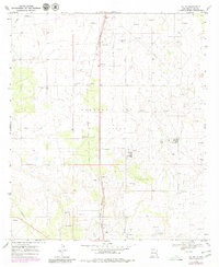
1969 Map of Jal NW
USGS Topo · Published 1972About this map
Monument Jal Oil Field dominates the landscape of southeast New Mexico in this late 1960s survey, illustrating the industrial footprint of the petroleum industry on the high plains. The town of Jal sits near the southern edge of the map, served by the Texas New Mexico railroad line and a network of infrastructure including a Pumping Sta, Substa, and a large Gas Plant. Evidence of community and recreation appears in the Golf Course and County Airport located just outside the main settlement.
Find a feature on this map
18 named features on this map. Tap any name to fly to it.
Don’t see what you’re looking for? This feature index may not catch every label — zoom into the map to look around manually.
Map Details
Editions of this 1969 Jal NW Map
2 editions found
Other maps of this area

1954 · Hobbs
USGS Topo · 1:250,000

1958 · Hobbs
USGS Topo · 1:250,000

1963 · Oil Center
USGS Topo · 1:62,500

1969 · Jal NE
USGS Topo · 1:24,000

1969 · Eunice SE
USGS Topo · 1:24,000

1969 · Jal
USGS Topo · 1:24,000

1969 · Rattlesnake Canyon
USGS Topo · 1:24,000

1969 · Jal SE
USGS Topo · 1:24,000

1973 · Javelina Basin
USGS Topo · 1:24,000

1973 · Custer Mountain
USGS Topo · 1:24,000