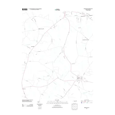
2013 Map of Hobgood
USGS Topo · Published 2013About this map
The town of Hobgood serves as the primary hub of this eastern North Carolina landscape, where a grid of streets meets a network of rural routes at the dawn of the 21st century. The surrounding terrain is defined by low-lying wetlands including Marsh Swamp, Etheridge Swamp, and the winding Deep Cr, which shape the agricultural and settlement patterns of Halifax County. Historically significant locations like Edwards Fork and Mullins Crossroads mark established junctions in a region traditionally tied to farming and land-based commerce. The map records several distinct rural communities, such as Roseneath and Braswells Crossroads, while agricultural operations like East Pork Farms highlight the modern industrial character of the local economy. For those tracing regional development, the road names often reflect family or geographic landmarks, such as Shields Commissary Rd and Bynums Bridge Rd, preserving local nomenclature in a digital-era survey.
Find a feature on this map
78 named features on this map. Tap any name to fly to it.
Don’t see what you’re looking for? This feature index may not catch every label — zoom into the map to look around manually.
Map Details
Editions of this 2013 Hobgood Map
This is the sole edition of this map. No revisions or reprints were ever made.
Other maps of this area

1901 · Parmele
USGS Topo · 1:62,500

1902 · Parmele
USGS Topo · 1:62,500

1902 · Tarboro
USGS Topo · 1:62,500

1903 · Tarboro
USGS Topo · 1:62,500

1953 · Norfolk
USGS Topo · 1:250,000

1953 · Rocky Mount
USGS Topo · 1:250,000

1954 · Rocky Mount
USGS Topo · 1:250,000

1960 · Dawson Crossroads
USGS Topo · 1:24,000

1960 · Draughn
USGS Topo · 1:24,000

1962 · Palmyra
USGS Topo · 1:24,000