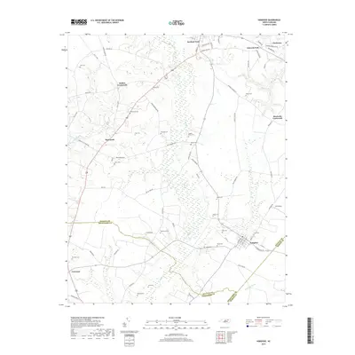
2019 Map of Hobgood
USGS Topo · Published 2019About this map
Scotland Neck and Hobgood anchor this eastern North Carolina landscape, where the flat coastal plain is deeply carved by drainage systems like Cow Haul Swamp and Marsh Swamp. The area's agricultural and social history is evidenced by numerous family-named landmarks and crossroads communities such as Mullins Crossroads and Roseneath. A significant network of local roads, including Bells Bridges RD and Whites Fork RD, connects these small settlements across the Halifax and Edgecombe county line. Genealogists will find the map particularly useful for its high density of family burial sites, from the Leggett House Cem to the Staton Cem and Hardy Cem. This 2019 survey documents the enduring rural character of the region, featuring Ellis Airport and the distinct boundary where Edgecombe and Martin counties meet near Etheridge Swamp.
Find a feature on this map
75 named features on this map. Tap any name to fly to it.
Don’t see what you’re looking for? This feature index may not catch every label — zoom into the map to look around manually.
Map Details
Editions of this 2019 Hobgood Map
This is the sole edition of this map. No revisions or reprints were ever made.
Other maps of this area

1901 · Parmele
USGS Topo · 1:62,500

1902 · Parmele
USGS Topo · 1:62,500

1902 · Tarboro
USGS Topo · 1:62,500

1903 · Tarboro
USGS Topo · 1:62,500

1953 · Norfolk
USGS Topo · 1:250,000

1953 · Rocky Mount
USGS Topo · 1:250,000

1954 · Rocky Mount
USGS Topo · 1:250,000

1960 · Dawson Crossroads
USGS Topo · 1:24,000

1960 · Draughn
USGS Topo · 1:24,000

1962 · Palmyra
USGS Topo · 1:24,000