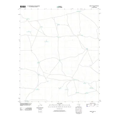
2010 Map of Hobo Tank
USGS Topo · Published 2010About this map
Hobo Tank serves as a namesake landmark in this arid expanse of Hudspeth County, where water management is the primary signature on the landscape. The distribution of features like Butterfield Tank and Last Chance Tank reflects the essential infrastructure of West Texas ranching and transit in the early 21st century. A network of unimproved and 4WD roads connects these catchments, tracing a path through the terrain to sites such as Freak Well Tank and West Lost Valley Tank. The nomenclature suggests a history of local distance and livestock movement, seen in labels like East Elevenmile Tank and Ninemile Tank. Toward the southern reaches, the map records Big Canyon Tank and Salvador Tank, illustrating how these points of water provided necessary anchors for activity in an otherwise sparse and open environment.
Find a feature on this map
25 named features on this map. Tap any name to fly to it.
Don’t see what you’re looking for? This feature index may not catch every label — zoom into the map to look around manually.
Map Details
Editions of this 2010 Hobo Tank Map
This is the sole edition of this map. No revisions or reprints were ever made.
Other maps of this area

1903 · Cerro Alto
USGS Topo · 1:125,000

1940 · Bassett Lake
USGS Topo · 1:62,500

1941 · Heuco Mountains
USGS Topo · 1:62,500

1943 · San Antonio Mtn
USGS Topo · 1:62,500

1943 · Heuco Mountains
USGS Topo · 1:62,500

1943 · Bassett Lake
USGS Topo · 1:62,500

1954 · Carlsbad
USGS Topo · 1:250,000

1954 · Van Horn
USGS Topo · 1:250,000

1958 · Van Horn
USGS Topo · 1:250,000

1958 · Carlsbad
USGS Topo · 1:250,000