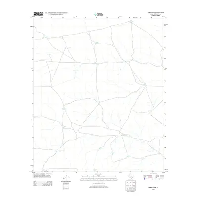
2012 Map of Hobo Tank
USGS Topo · Published 2012About this map
Hobo Tank serves as a central landmark in this arid stretch of Hudspeth County, where a complex network of water catchments and wells sustains the landscape. The distribution of these features, from Butterfield Tank in the north to Fernando Tank in the south, indicates a reliance on managed water sources for ranching and land use. The presence of named locations like W Lost Valley Tank and Big Canyon Tank highlights the natural drainages that define the local topography, while features such as Last Chance Tank and Freak Well Tank suggest the vital and sometimes precarious nature of water access in this high desert environment. The map details a web of secondary roads connecting these scattered tanks, including Antelope Lake Tank and Ninemile Tank, providing a clear view of the infrastructure supporting this remote part of West Texas during the early 21st century.
Find a feature on this map
26 named features on this map. Tap any name to fly to it.
Don’t see what you’re looking for? This feature index may not catch every label — zoom into the map to look around manually.
Map Details
Editions of this 2012 Hobo Tank Map
This is the sole edition of this map. No revisions or reprints were ever made.
Other maps of this area

1903 · Cerro Alto
USGS Topo · 1:125,000

1940 · Bassett Lake
USGS Topo · 1:62,500

1941 · Heuco Mountains
USGS Topo · 1:62,500

1943 · San Antonio Mtn
USGS Topo · 1:62,500

1943 · Heuco Mountains
USGS Topo · 1:62,500

1943 · Bassett Lake
USGS Topo · 1:62,500

1954 · Carlsbad
USGS Topo · 1:250,000

1954 · Van Horn
USGS Topo · 1:250,000

1958 · Van Horn
USGS Topo · 1:250,000

1958 · Carlsbad
USGS Topo · 1:250,000