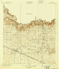
1920 Map of Hockley
USGS Topo · Published 1939About this map
Hockley serves as the primary hub of this 1916 survey, situated where the Southern Pacific System tracks parallel the Houston Hempstead and Texas Central Road. The landscape is defined by the drainage basins of Spring Creek, Kickapoo Creek, and Little Cypress Creek, which carved the undulating terrain long before the area's modern development. Local industry and social life are anchored by the Bauers Sawmill and Bauers Store in the northern reaches, while education for the surrounding farmsteads was provided at the Georgia School and Hegar School. This map captures Harris County at a pivotal moment when transportation was still dictated by traditional overland routes like Magnolia Road and Rose Hill Road, showing the transition from an agricultural and timber-based economy to a more connected regional network.
Find a feature on this map
19 named features on this map. Tap any name to fly to it.
Don’t see what you’re looking for? This feature index may not catch every label — zoom into the map to look around manually.
Map Details
Editions of this 1920 Hockley Map
3 editions found
Other maps of this area

1915 · Cypress
USGS Topo · 1:24,000

1916 · Rose Hill
USGS Topo · 1:24,000

1916 · Hockley
USGS Topo · 1:24,000

1916 · Swanson
USGS Topo · 1:24,000

1918 · Cypress
USGS Topo · 1:31,680

1919 · Swanson
USGS Topo · 1:31,680

1920 · Hockley
USGS Topo · 1:31,680

1920 · Rose Hill
USGS Topo · 1:31,680

1920 · Waller
USGS Topo · 1:31,680

1950 · Houston
USGS Topo · 1:250,000