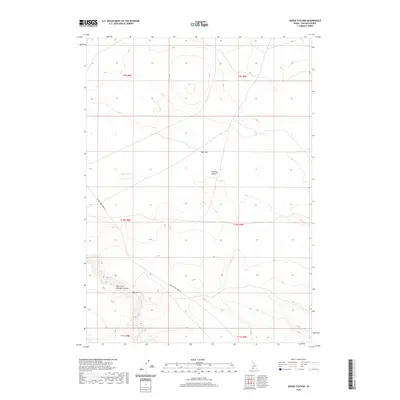
2020 Map of Hodge Station
USGS Topo · Published 2020About this map
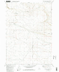
Hodge Station serves as a lone point of reference in the wide, arid expanse of the Bruneau Desert in southwestern Idaho. The landscape is defined by the deep incision of the East Fork Bruneau Canyon to the southwest, where Clover Cr flows toward its confluence. This high-desert terrain is marked by significant topographical shifts such as Big Draw, illustrating the erosion patterns characteristic of the Owyhee plateau. Modern connectivity across this isolated geography is maintained by the Clover Three Creek Rd, which traces a path through the southern portion of the quadrangle. The map detail highlights the sparse settlement patterns and the dominance of natural drainage features in this portion of Idaho's high desert country.
Find a feature on this map
12 named features on this map. Tap any name to fly to it.
Don’t see what you’re looking for? This feature index may not catch every label — zoom into the map to look around manually.
Map Details
Editions of this 2020 Hodge Station Map
This is the sole edition of this map. No revisions or reprints were ever made.
Other maps of this area

1955 · Twin Falls
USGS Topo · 1:250,000

1956 · Blue Butte
USGS Topo · 1:62,500

1956 · Winter Camp
USGS Topo · 1:62,500

1958 · Twin Falls
USGS Topo · 1:250,000

1979 · Stiff Tree Draw
USGS Topo · 1:24,000

1980 · Clover Butte North
USGS Topo · 1:24,000
1980 · Black Butte East
USGS Topo · 1:24,000
1980 · Juniper Ranch
USGS Topo · 1:24,000
1980 · Crows Nest Butte
USGS Topo · 1:24,000
1980 · Black Butte West
USGS Topo · 1:24,000