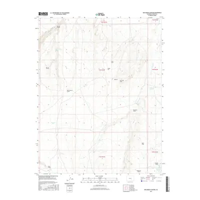
2016 Map of Hog Ranch Canyon
USGS Topo · Published 2016About this map
Huerfano River drainage patterns define this high-plains landscape in Pueblo County, where seasonal arroyos and canyons cut through the terrain. The presence of Finn Cem in the northeast and the Homestead Reservoir to the south suggests the long-term human footprint on this ranching land. Named landmarks like Sawtooth Peak and the nearby Haystack provide vertical orientation amidst a network of canyons including Hog Ranch Canyon and Horse Pasture Canyon. Water remains the central character of the map, documented through scattered points like Karrick Spring, Cottonwood Spring, and Hog Springs, as well as the larger Gaalegos Reservoir, reflecting the essential infrastructure required for survival in this arid region.
Find a feature on this map
30 named features on this map. Tap any name to fly to it.
Don’t see what you’re looking for? This feature index may not catch every label — zoom into the map to look around manually.
Map Details
Editions of this 2016 Hog Ranch Canyon Map
This is the sole edition of this map. No revisions or reprints were ever made.
Other maps of this area

1891 · Walsenburg
USGS Topo · 1:125,000

1891 · Pueblo
USGS Topo · 1:125,000

1891 · Nepesta
USGS Topo · 1:125,000

1891 · Apishapa
USGS Topo · 1:125,000

1893 · Nepesta
USGS Topo · 1:125,000

1893 · Apishapa
USGS Topo · 1:125,000

1894 · Walsenburg
USGS Topo · 1:125,000

1894 · Pueblo
USGS Topo · 1:125,000

1896 · Pueblo
USGS Topo · 1:125,000

1897 · Pueblo
USGS Topo · 1:125,000