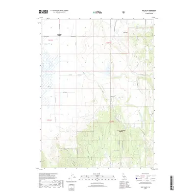
2018 Map of Hog Valley
USGS Topo · Published 2018About this map
Pumpkin Center sits at the crossroads of Punkin Center Rd and Bunselmeier Rd, marking a pocket of development in this high-desert transition zone. The landscape is defined by the sharp contrast between the agricultural expanse of Big Valley to the west, fed by the Big Valley Canal, and the rising timberlands of the Modoc National Forest to the east. The terrain transitions from flat irrigated fields into the complex drainage networks of Juniper Creek and its various forks, eventually climbing toward Indian Peak.
Find a feature on this map
44 named features on this map. Tap any name to fly to it.
Don’t see what you’re looking for? This feature index may not catch every label — zoom into the map to look around manually.
Map Details
Editions of this 2018 Hog Valley Map
This is the sole edition of this map. No revisions or reprints were ever made.
Other maps of this area

1886 · Alturas
USGS Topo · 1:250,000

1886 · Honey Lake
USGS Topo · 1:250,000

1886 · Lassen Peak
USGS Topo · 1:250,000

1886 · Modoc Lava Bed
USGS Topo · 1:250,000

1891 · Honey Lake
USGS Topo · 1:250,000

1892 · Modoc Lava-Bed
USGS Topo · 1:250,000

1892 · Lassen Peak
USGS Topo · 1:250,000

1892 · Alturas
USGS Topo · 1:250,000

1893 · Honey Lake
USGS Topo · 1:250,000

1894 · Lassen Peak
USGS Topo · 1:250,000