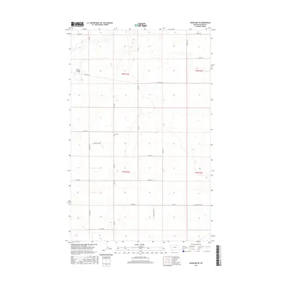
2017 Map of Hogeland SE
USGS Topo · Published 2017About this map
The rolling plains of Blaine County near the Canadian border are defined by a strict grid of section lines and rural thoroughfares. Murray Coulee cuts across the northwestern portion of the landscape, providing a rare break in the topography of this high-plains region. The map reveals a deeply established network of local roads named for the families and pioneers who settled this area, including Bevolden Rd, Mohar Rd, and Wallen Rd. A focal point for local history is the Wing Cem, located along Wing Rd in Township 35 North. Small intermittent water features such as Buckley Cr and several unnamed depressions suggest a landscape where water management was critical to ranching and dryland farming operations in the early 21st century.
Find a feature on this map
24 named features on this map. Tap any name to fly to it.
Don’t see what you’re looking for? This feature index may not catch every label — zoom into the map to look around manually.
Map Details
Editions of this 2017 Hogeland SE Map
This is the sole edition of this map. No revisions or reprints were ever made.
Other maps of this area

1903 · Wayne Creek
USGS Topo · 1:62,500

1905 · Wayne Creek
USGS Topo · 1:62,500

1913 · Cherry Ridge
USGS Topo · 1:125,000

1920 · Avery
USGS Topo · 1:125,000

1953 · Havre
USGS Topo · 1:250,000

1957 · Havre
USGS Topo · 1:250,000

1958 · Havre
USGS Topo · 1:250,000

1984 · Hogeland SE
USGS Topo · 1:24,000

1984 · Turner
USGS Topo · 1:24,000
1984 · Down Reservoir NW
USGS Topo · 1:24,000