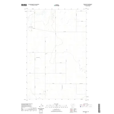
2020 Map of Hogeland SE
USGS Topo · Published 2020About this map
Wing Cem serves as a quiet landmark in this high plains landscape of northern Blaine County, situated near the intersection of Wing Rd and Twete Rd. The terrain is characterized by broad agricultural sections and the drainage of Murray Coulee in the northwest. The map captures a grid of rural section roads, many bearing local family names like Bevolden Rd, Mohar Rd, and Wallen Rd, which delineate the expansive townships of t36n r24e and t35n r24e. This network of roads and small water catchments illustrates the enduring structure of dryland farming and ranching north of the Milk River valley, where isolated homesteads are connected by long stretches such as Hogeland Rd and Rafter Rd.
Find a feature on this map
23 named features on this map. Tap any name to fly to it.
Don’t see what you’re looking for? This feature index may not catch every label — zoom into the map to look around manually.
Map Details
Editions of this 2020 Hogeland SE Map
This is the sole edition of this map. No revisions or reprints were ever made.
Other maps of this area

1903 · Wayne Creek
USGS Topo · 1:62,500

1905 · Wayne Creek
USGS Topo · 1:62,500

1913 · Cherry Ridge
USGS Topo · 1:125,000

1920 · Avery
USGS Topo · 1:125,000

1953 · Havre
USGS Topo · 1:250,000

1957 · Havre
USGS Topo · 1:250,000

1958 · Havre
USGS Topo · 1:250,000

1984 · Hogeland SE
USGS Topo · 1:24,000

1984 · Turner
USGS Topo · 1:24,000
1984 · Down Reservoir NW
USGS Topo · 1:24,000