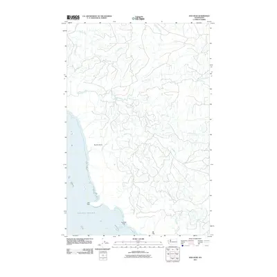
2011 Map of Hoh Head
USGS Topo · Published 2011About this map
Oil City sits at the southern edge of this coastal landscape, marking a historical point of settlement where the terrestrial world meets the Pacific Ocean. The geography is defined by a dense network of drainage systems, including Goodman Creek, Minter Creek, and Mosquito Creek, which carve through the terrain before reaching the shore. Significant coastal landmarks like Hoh Head and Diamond Rock punctuate the waterline, providing distinct navigational points along this section of the Washington coast.
Find a feature on this map
13 named features on this map. Tap any name to fly to it.
Don’t see what you’re looking for? This feature index may not catch every label — zoom into the map to look around manually.
Map Details
Editions of this 2011 Hoh Head Map
This is the sole edition of this map. No revisions or reprints were ever made.
Other maps of this area

1939 · Forks
USGS Topo · 1:62,500

1943 · Copalis Beach
USGS Topo · 1:250,000

1951 · Copalis Beach
USGS Topo · 1:250,000

1956 · Destruction Island
USGS Topo · 1:62,500

1956 · La Push
USGS Topo · 1:62,500

1957 · Forks
USGS Topo · 1:62,500

1957 · Copalis Beach
USGS Topo · 1:250,000

1963 · Copalis Beach
USGS Topo · 1:250,000
1981 · Forks
USGS Topo · 1:24,000
1981 · Reade Hill
USGS Topo · 1:24,000