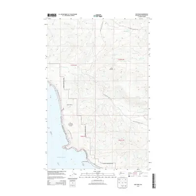
2014 Map of Hoh Head
USGS Topo · Published 2014About this map
The Pacific Ocean coastline meets the dense forests of the Olympic National Park in this coastal survey. A rugged intersection of maritime and wilderness features defines the area, highlighted by the prominent Hoh Head and the rocky outcrop of Diamond Rock. Inland from the shoreline at Boulder Beach, the terrain rises toward the Olympic Mountains, drained by a network of waterways including Goodman Creek, Mosquito Cr, and Minter Cr.
Find a feature on this map
21 named features on this map. Tap any name to fly to it.
Don’t see what you’re looking for? This feature index may not catch every label — zoom into the map to look around manually.
Map Details
Editions of this 2014 Hoh Head Map
This is the sole edition of this map. No revisions or reprints were ever made.
Other maps of this area

1939 · Forks
USGS Topo · 1:62,500

1943 · Copalis Beach
USGS Topo · 1:250,000

1951 · Copalis Beach
USGS Topo · 1:250,000

1956 · Destruction Island
USGS Topo · 1:62,500

1956 · La Push
USGS Topo · 1:62,500

1957 · Forks
USGS Topo · 1:62,500

1957 · Copalis Beach
USGS Topo · 1:250,000

1963 · Copalis Beach
USGS Topo · 1:250,000
1981 · Forks
USGS Topo · 1:24,000
1981 · Reade Hill
USGS Topo · 1:24,000