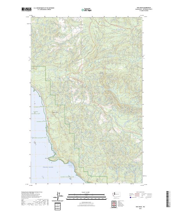
2023 Map of Hoh Head
USGS Topo · Published 2023About this map
Hoh Head and the surrounding coastal wilderness of Jefferson County are preserved here in this recent topographic survey. The area is characterized by the confluence of the Pacific Ocean and the coastal foothills of the Olympic Mountains. A notable industrial artifact appears at the southern edge of the map: the settlement of Oil City, situated near an Oil Seep along the coast. This location represents a unique chapter in the region’s attempts at resource extraction within a landscape now dominated by conservation. The map details the complex boundaries of the Washington Islands Wilderness and the Quillayute Needles National Wildlife Refuge, which protect the offshore stacks and rugged shoreline. Inland, the Pacific Northwest National Scenic Trail winds through timberlands and across numerous drainages like Goodman Creek and Mosquito Creek, providing a look at the modern trail system that navigates this preserved coastal corridor.
Find a feature on this map
24 named features on this map. Tap any name to fly to it.
Don’t see what you’re looking for? This feature index may not catch every label — zoom into the map to look around manually.
Map Details
Editions of this 2023 Hoh Head Map
This is the sole edition of this map. No revisions or reprints were ever made.
Other maps of this area

1939 · Forks
USGS Topo · 1:62,500

1943 · Copalis Beach
USGS Topo · 1:250,000

1951 · Copalis Beach
USGS Topo · 1:250,000

1956 · Destruction Island
USGS Topo · 1:62,500

1956 · La Push
USGS Topo · 1:62,500

1957 · Forks
USGS Topo · 1:62,500

1957 · Copalis Beach
USGS Topo · 1:250,000

1963 · Copalis Beach
USGS Topo · 1:250,000
1981 · Forks
USGS Topo · 1:24,000
1981 · Reade Hill
USGS Topo · 1:24,000