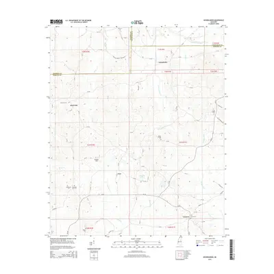
2015 Map of Hohenlinden
USGS Topo · Published 2015About this map
Hohenlinden and the surrounding borderlands of Chickasaw, Calhoun, and Webster counties reveal a landscape defined by small crossroads settlements and an intricate network of waterways. The Big Black River snakes through the eastern section, while the Topashaw Cr Canal and Little Topashaw Cr drain the central and northern reaches. The terrain rises into the Beasley Hills west of Fame, providing a topographical break from the creek bottoms. Genealogists will find a high density of burial grounds throughout this rural area, including the Montevista Cem, Double Springs Cem, and the uniquely named Old Shady Grove Cem. The map illustrates a primarily agricultural and rural residential character, with long stretches of county roads like Old Cumberland Rd and Chestnut Springs Cemetery Rd connecting the scattered communities of Montevista and Clarkson.
Find a feature on this map
83 named features on this map. Tap any name to fly to it.
Don’t see what you’re looking for? This feature index may not catch every label — zoom into the map to look around manually.
Map Details
Editions of this 2015 Hohenlinden Map
This is the sole edition of this map. No revisions or reprints were ever made.
Other maps of this area

1953 · Walthall
USGS Topo · 1:62,500

1953 · West Point
USGS Topo · 1:250,000

1954 · Pittsboro
USGS Topo · 1:62,500

1958 · West Point
USGS Topo · 1:250,000

1963 · West Point
USGS Topo · 1:250,000

1972 · Maben
USGS Topo · 1:24,000

1972 · Atlanta
USGS Topo · 1:24,000

1972 · Sapa
USGS Topo · 1:24,000

1972 · Hohenlinden
USGS Topo · 1:24,000

1972 · Mantee
USGS Topo · 1:24,000