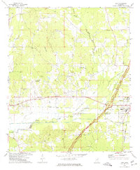
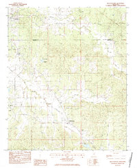
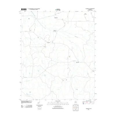
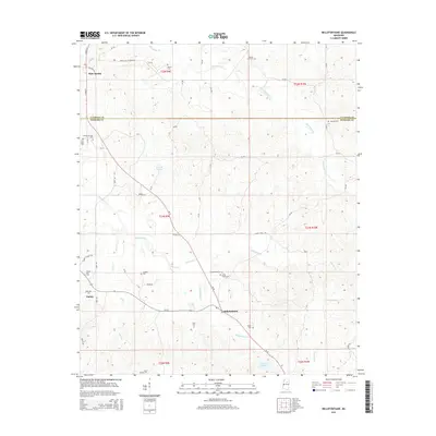
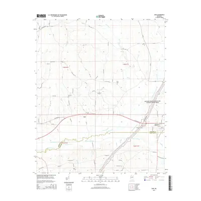
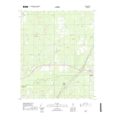
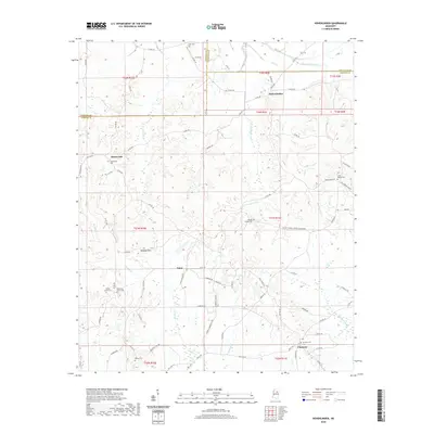
1972 Map of Sapa
USGS Topo · Published 1974About this map
The Big Black River and its accompanying Canal carve a significant path through the rural landscape of north-central Mississippi, marking the border where Webster and Choctaw counties meet. During the early 1970s, the region was characterized by small agricultural communities like Sapa and the town of Mathiston, which served as a local hub for education and transport. The campus of Wood Junior College stands out on the eastern edge of the map, while the Illinois Central Gulf railroad and the Natchez Trace Parkway provide the primary transit corridors. Cultural life is anchored by numerous country churches, including New Hope Ch, Mt Moriah Ch, and Calvary Ch. Notable recreational and industrial sites of the era, such as a Drive-in Theater, a local Golf Course, and a Clay Pit, reflect the mid-century development patterns of these rural hill country townships.
Find a feature on this map
32 named features on this map. Tap any name to fly to it.
Don’t see what you’re looking for? This feature index may not catch every label — zoom into the map to look around manually.
Map Details
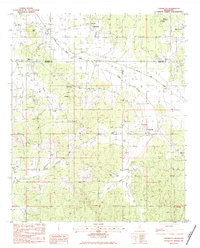
Editions of this 1972 Sapa Map
This is the sole edition of this map. No revisions or reprints were ever made.
Historical Maps of Mathiston Through Time
32 maps found
1972 Hohenlinden
Webster County, MS
1972 Sapa
Webster County, MS
1976 Walthall NE
Webster County, MS
1976 Walthall SE
Webster County, MS
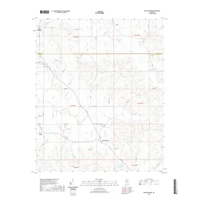
1983 Bellefontaine
Webster County, MS
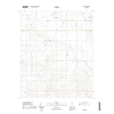
1983 Cadaretta
Webster County, MS
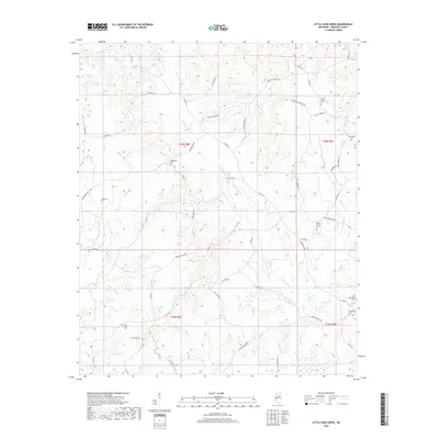
1983 Little Sand Creek
Webster County, MS
2012 Bellefontaine
Webster County, MS
2012 Cadaretta
Webster County, MS
2012 Hohenlinden
Webster County, MS
2012 Little Sand Creek
Webster County, MS
2012 Sapa
Webster County, MS
2015 Bellefontaine
Webster County, MS
2015 Cadaretta
Webster County, MS
2015 Hohenlinden
Webster County, MS
2015 Little Sand Creek
Webster County, MS
2015 Sapa
Webster County, MS
2018 Bellefontaine
Webster County, MS
2018 Cadaretta
Webster County, MS
2018 Hohenlinden
Webster County, MS
2018 Little Sand Creek
Webster County, MS
2018 Sapa
Webster County, MS
2020 Bellefontaine
Webster County, MS
2020 Cadaretta
Webster County, MS
2020 Hohenlinden
Webster County, MS
2020 Sapa
Webster County, MS
2021 Little Sand Creek
Webster County, MS
2024 Bellefontaine
Webster County, MS
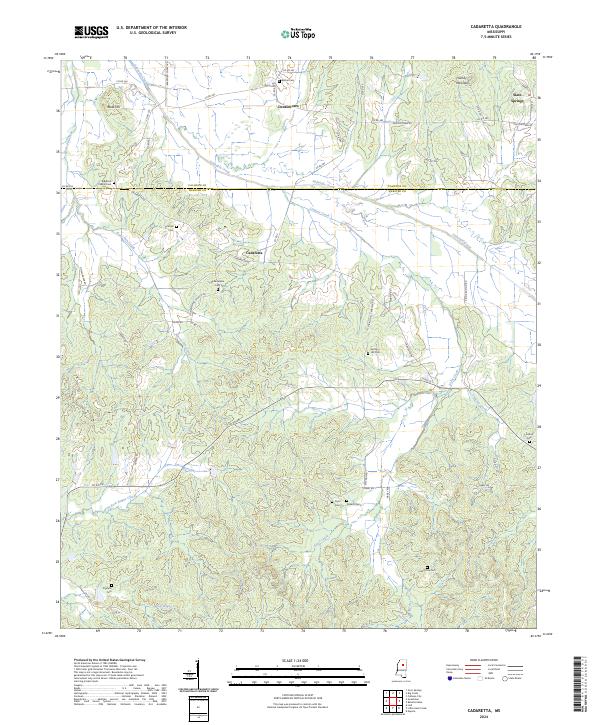
2024 Cadaretta
Webster County, MS
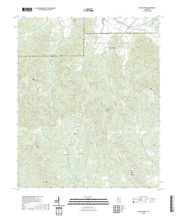
2024 Hohenlinden
Webster County, MS
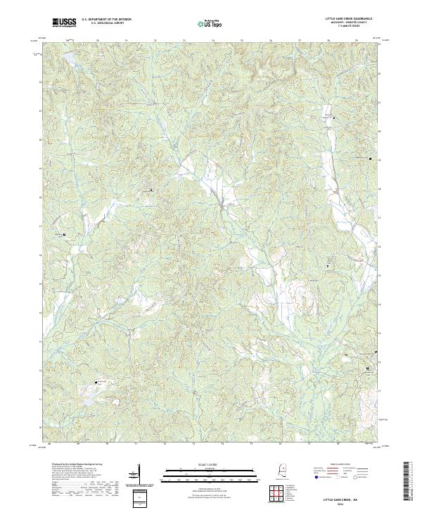
2024 Little Sand Creek
Webster County, MS
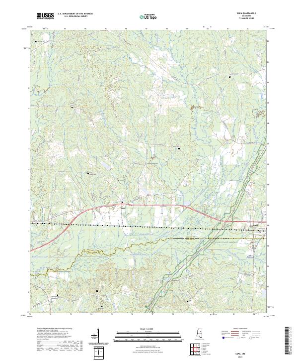
2024 Sapa
Webster County, MS