
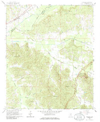
1966 Map of Tomnolen
USGS Topo · Published 1967About this map
The Big Black River and its accompanying Short Canal define the northern lowlands of this central Mississippi landscape, where the Columbus and Greenville railroad passes through the small community of Tomnolen. Much of the quadrangle is characterized by the complex drainage network of the Middle Bywy Creek and McCurtain Creek systems, which have shaped the local geography between the borders of Webster and Choctaw counties.
Find a feature on this map
43 named features on this map. Tap any name to fly to it.
Don’t see what you’re looking for? This feature index may not catch every label — zoom into the map to look around manually.
Map Details
Editions of this 1966 Tomnolen Map
2 editions found
Other maps of this area

1953 · Walthall
USGS Topo · 1:62,500

1953 · West Point
USGS Topo · 1:250,000

1958 · West Point
USGS Topo · 1:250,000

1963 · West Point
USGS Topo · 1:250,000

1966 · Stewart
USGS Topo · 1:24,000

1966 · Weir
USGS Topo · 1:24,000

1966 · French Camp
USGS Topo · 1:24,000

1968 · Weir
USGS Topo · 1:62,500

1972 · Sapa
USGS Topo · 1:24,000
1972 · Reform
USGS Topo · 1:24,000