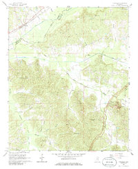
1966 Map of Tomnolen
USGS Topo · Published 1986About this map
The Columbus and Greenville railroad corridor defines the northern edge of this Choctaw County landscape, passing through the settlement of Tomnolen. To the south, the Natchez Trace Parkway curves across the terrain, leading to Jeff Busby Park and the notable elevation of Little Mountain. This mid-century survey captures a rural Mississippi community defined by its waterways and small country churches, from the Big Black River and its associated Canal to the winding course of Middle Bywy Creek.
Find a feature on this map
43 named features on this map. Tap any name to fly to it.
Don’t see what you’re looking for? This feature index may not catch every label — zoom into the map to look around manually.
Map Details
Editions of this 1966 Tomnolen Map
2 editions found
Other maps of this area

1953 · Walthall
USGS Topo · 1:62,500

1953 · West Point
USGS Topo · 1:250,000

1958 · West Point
USGS Topo · 1:250,000

1963 · West Point
USGS Topo · 1:250,000

1966 · Stewart
USGS Topo · 1:24,000

1966 · Weir
USGS Topo · 1:24,000

1966 · Tomnolen
USGS Topo · 1:24,000

1966 · French Camp
USGS Topo · 1:24,000

1968 · Weir
USGS Topo · 1:62,500

1972 · Sapa
USGS Topo · 1:24,000