
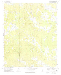
1972 Map of Double Springs
USGS Topo · Published 1975About this map
Double Springs and its namesake Double Springs Ch sit at the center of this rural landscape where the border of Choctaw and Oktibbeha counties meets. The area is defined by a dense network of country churches and family burial grounds, reflecting the deep-rooted community structure of the early 1970s. From the Maben Lookout Tower in the north to the Pleasant Ridge Ch in the south, the terrain is carved by numerous waterways including Lick Creek, Self Creek, and Trim Cane Creek. Local industry and land use are evidenced by a Gas Well near the center of the quadrangle and a Sandpit to the west, while a prominent Pipeline cuts diagonally across the southern half of the map. This survey provides a clear view of the agricultural and religious life in the region before modern development altered these traditional boundaries.
Find a feature on this map
25 named features on this map. Tap any name to fly to it.
Don’t see what you’re looking for? This feature index may not catch every label — zoom into the map to look around manually.
Map Details
Editions of this 1972 Double Springs Map
2 editions found
Other maps of this area

1953 · West Point
USGS Topo · 1:250,000

1958 · West Point
USGS Topo · 1:250,000

1959 · Pheba
USGS Topo · 1:62,500

1963 · West Point
USGS Topo · 1:250,000

1965 · Longview
USGS Topo · 1:24,000

1965 · Bradley
USGS Topo · 1:24,000

1972 · Maben
USGS Topo · 1:24,000

1972 · Sapa
USGS Topo · 1:24,000

1972 · Sturgis
USGS Topo · 1:24,000
1972 · Reform
USGS Topo · 1:24,000