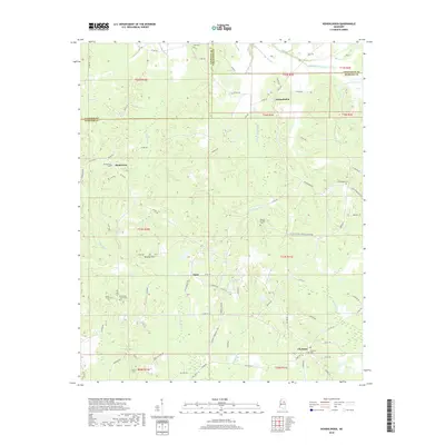
2018 Map of Hohenlinden
USGS Topo · Published 2018About this map
Clarkson and Hohenlinden anchor this rural landscape in north-central Mississippi, where the headwaters of the Big Black River and Savannah Cr wind through a patchwork of timber and small-scale agriculture. The terrain is defined by the Beasley Hills and a network of named creeks, including the engineered Topashaw Cr Canal which highlights early 20th-century water management efforts in the region. Local history is deeply embedded in the land through numerous family and community burial grounds such as Ball Cem, Double Springs Cem, and Hebron Cem. Small settlements like Montevista and Fame remain connected by a dense web of county roads like Vickers Double Springs Church Rd, showing a settlement pattern that has persisted for generations along the borders of Calhoun, Chickasaw, and Webster counties.
Find a feature on this map
82 named features on this map. Tap any name to fly to it.
Don’t see what you’re looking for? This feature index may not catch every label — zoom into the map to look around manually.
Map Details
Editions of this 2018 Hohenlinden Map
This is the sole edition of this map. No revisions or reprints were ever made.
Other maps of this area

1953 · Walthall
USGS Topo · 1:62,500

1953 · West Point
USGS Topo · 1:250,000

1954 · Pittsboro
USGS Topo · 1:62,500

1958 · West Point
USGS Topo · 1:250,000

1963 · West Point
USGS Topo · 1:250,000

1972 · Maben
USGS Topo · 1:24,000

1972 · Atlanta
USGS Topo · 1:24,000

1972 · Sapa
USGS Topo · 1:24,000

1972 · Hohenlinden
USGS Topo · 1:24,000

1972 · Mantee
USGS Topo · 1:24,000