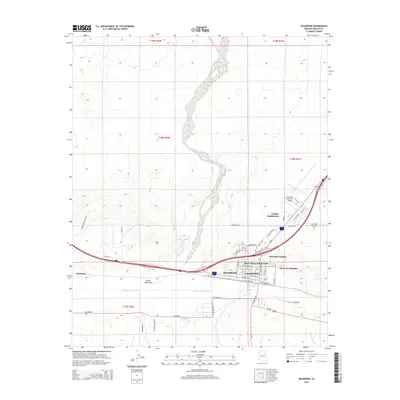
2014 Map of Holbrook
USGS Topo · Published 2014About this map
The Little Colorado River winds through the heart of this high-desert landscape, defining the geographic orientation of Holbrook and its surrounding residential developments. The town's mid-20th-century expansion is evidenced by established residential areas like the Lisitzky Subdivision, Sierra Plaza Subdivision, and Rosedale Heights, which sit tucked between the river and the northern transport corridors. To the west, the settlement of Penzance marks a distinct point along the rail and road network.
Find a feature on this map
43 named features on this map. Tap any name to fly to it.
Don’t see what you’re looking for? This feature index may not catch every label — zoom into the map to look around manually.
Map Details
Editions of this 2014 Holbrook Map
This is the sole edition of this map. No revisions or reprints were ever made.
Other maps of this area

1883 · Tusayan
USGS Topo · 1:250,000

1886 · Tusayan
USGS Topo · 1:250,000

1886 · Holbrook
USGS Topo · 1:250,000

1893 · Holbrook
USGS Topo · 1:250,000

1947 · Flagstaff
USGS Topo · 1:250,000

1954 · Flagstaff
USGS Topo · 1:250,000

1954 · Holbrook
USGS Topo · 1:250,000

1955 · St. Joseph 1 NE
USGS Topo · 1:24,000

1955 · St. Joseph 2 SE
USGS Topo · 1:24,000

1955 · St. Joseph 1 SE
USGS Topo · 1:24,000
Featured Places
- Holbrook, AZ
- Sierra Plaza subdivision, Holbrook
- Clearview Heights, Holbrook
- Lisitzky Subdivision, Holbrook
- Rosedale Heights, Holbrook