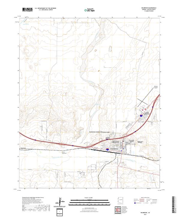
2021 Map of Holbrook
USGS Topo · Published 2021About this map
The Little Colorado River winds through the heart of this landscape, anchoring the high-desert hub of Holbrook. This modern survey reveals the town's growth into distinct residential areas such as the Sierra Plaza Subdivision, Rosedale Heights, and Clearview Heights. Just to the east, the boundary of Petrified Forest National Park marks the edge of a protected geological wilderness, while the seasonal courses of Leroux Wash and Jacobs Wash drain the surrounding arid terrain. Genealogists will find the Holbrook Cem centrally located near the river, while local historians can trace the transit corridors from the Holbrook Municipal Airport to the western outskirts near the small settlement of Penzance. The map illustrates a crossroads of modern infrastructure and natural history, where the residential expansion of Navajo County meets the ancient lithified remains and wide washes of northern Arizona.
Find a feature on this map
55 named features on this map. Tap any name to fly to it.
Don’t see what you’re looking for? This feature index may not catch every label — zoom into the map to look around manually.
Map Details
Editions of this 2021 Holbrook Map
This is the sole edition of this map. No revisions or reprints were ever made.
Other maps of this area

1883 · Tusayan
USGS Topo · 1:250,000

1886 · Tusayan
USGS Topo · 1:250,000

1886 · Holbrook
USGS Topo · 1:250,000

1893 · Holbrook
USGS Topo · 1:250,000

1947 · Flagstaff
USGS Topo · 1:250,000

1954 · Flagstaff
USGS Topo · 1:250,000

1954 · Holbrook
USGS Topo · 1:250,000

1955 · St. Joseph 1 NE
USGS Topo · 1:24,000

1955 · St. Joseph 2 SE
USGS Topo · 1:24,000

1955 · St. Joseph 1 SE
USGS Topo · 1:24,000
Featured Places
- Holbrook, AZ
- Clearview Heights, Holbrook
- Lisitzky Subdivision, Holbrook
- Rosedale Heights, Holbrook
- Sierra Plaza subdivision, Holbrook