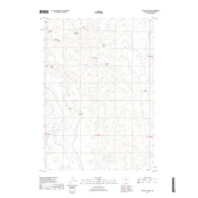
2017 Map of Hole-in-the-Wall
USGS Topo · Published 2017About this map
Hole-In-The-Wall defines this section of Johnson County, a name famously associated with outlaws of the Old West. The landscape is carved by a complex system of drainage channels such as Arminto Draw, Peterson Draw, and Shirk Draw, which feed into Buffalo Cr. This topography provided natural concealment and strategic movement for those navigating the frontier. Water remains a central element of the map's geography, indicated by isolated features like Taylor Spring and Shearing Pens Spring. High ground is marked by prominent formations including Steamboat Rock, Castle Rock, and Poker Butte. Human impact is visible through the primitive path of Bar C Rd, while the land is meticulously organized by the Public Land Survey System, including sections within t42n r83w and t41n r83w.
Find a feature on this map
24 named features on this map. Tap any name to fly to it.
Don’t see what you’re looking for? This feature index may not catch every label — zoom into the map to look around manually.
Map Details
Editions of this 2017 Hole-in-the-Wall Map
This is the sole edition of this map. No revisions or reprints were ever made.
Other maps of this area

1955 · Arminto
USGS Topo · 1:250,000

1958 · Arminto
USGS Topo · 1:250,000

1961 · Barnum
USGS Topo · 1:62,500

1961 · TTT Ranch
USGS Topo · 1:24,000

1961 · Kaycee
USGS Topo · 1:24,000

1962 · Arminto
USGS Topo · 1:250,000

1968 · Willow Creek School
USGS Topo · 1:24,000

1968 · Roughlock Hill
USGS Topo · 1:24,000
1968 · Broken Horn Creek
USGS Topo · 1:24,000
1979 · Red Fork Powder River
USGS Topo · 1:24,000