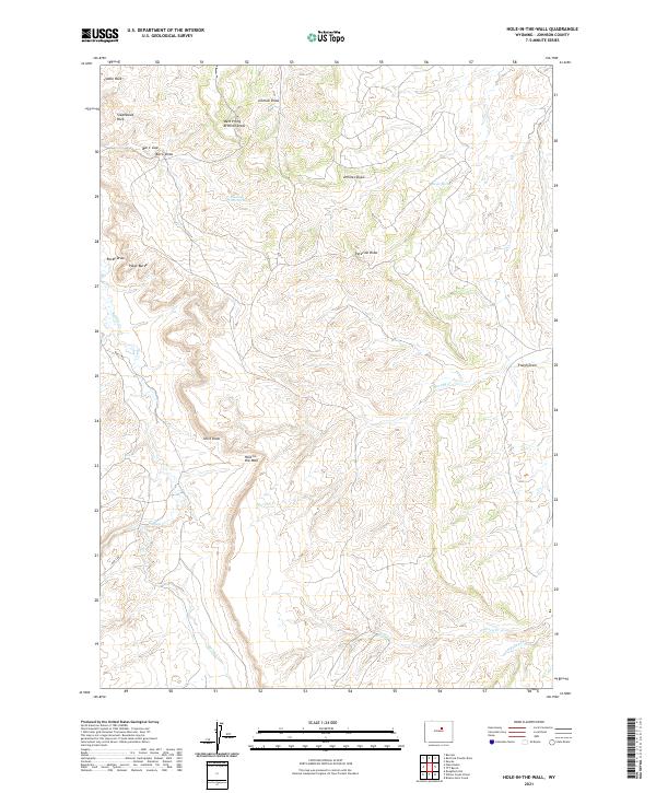
2021 Map of Hole-in-the-Wall
USGS Topo · Published 2021About this map
Hole-in-the-Wall, a geological break in the red sandstone cliffs of Johnson County, marks the western edge of this High Plains landscape. The drainage pattern here is defined by deep draws and creeks like Buffalo Cr and Murphy Cr, which carve through the high plateaus and ranching lands. This 2021 survey illustrates the continued importance of water sources in this arid environment, noting Shearing Pens Spring and Taylor Spring. The presence of Bar C Rd and the Bar C Gap reflects the region's enduring cattle ranching heritage, providing access through the steep terrain. Prominent landmarks such as Steamboat Rock, Castle Rock, and Poker Butte serve as vital navigational points across the open range, where topographic relief shifts from the winding Arminto Draw to the high ridges of the Powder River Basin.
Find a feature on this map
27 named features on this map. Tap any name to fly to it.
Don’t see what you’re looking for? This feature index may not catch every label — zoom into the map to look around manually.
Map Details
Editions of this 2021 Hole-in-the-Wall Map
This is the sole edition of this map. No revisions or reprints were ever made.
Other maps of this area

1955 · Arminto
USGS Topo · 1:250,000

1958 · Arminto
USGS Topo · 1:250,000

1961 · Barnum
USGS Topo · 1:62,500

1961 · TTT Ranch
USGS Topo · 1:24,000

1961 · Kaycee
USGS Topo · 1:24,000

1962 · Arminto
USGS Topo · 1:250,000

1968 · Willow Creek School
USGS Topo · 1:24,000

1968 · Roughlock Hill
USGS Topo · 1:24,000
1968 · Broken Horn Creek
USGS Topo · 1:24,000
1979 · Red Fork Powder River
USGS Topo · 1:24,000