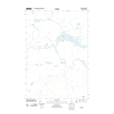
2011 Map of Holeb
USGS Topo · Published 2011About this map
Moose River dominates this northern Maine landscape, winding through a complex network of wetlands and interconnected water bodies in Somerset County. The settlement at Holeb sits along the river's path, connected by Holeb Rd to the surrounding wilderness. To the east, Holeb Pond is a prominent geographic feature, containing Birch Island and fed by Holeb Stream and Turner Brook. The presence of Boston Ranch on the southern shore of the pond provides a rare named landmark in this sparsely populated region.
Find a feature on this map
28 named features on this map. Tap any name to fly to it.
Don’t see what you’re looking for? This feature index may not catch every label — zoom into the map to look around manually.
Map Details
Editions of this 2011 Holeb Map
This is the sole edition of this map. No revisions or reprints were ever made.
Other maps of this area

1923 · Attean
USGS Topo · 1:62,500

1925 · Attean
USGS Topo · 1:62,500

1928 · Chain Lakes
USGS Topo · 1:48,000

1928 · Skinner
USGS Topo · 1:48,000

1928 · Spencer
USGS Topo · 1:48,000

1931 · Skinner
USGS Topo · 1:62,500

1932 · Spencer
USGS Topo · 1:62,500

1932 · Chain Lakes
USGS Topo · 1:62,500

1935 · Chain Lakes
USGS Topo · 1:62,500

1949 · Jackman
USGS Topo · 1:250,000
Featured Places
- Dennistown Plantation, ME
- Rayton Township, ME
- Holeb Township, ME
- Attean Township, ME
- Forsyth Township, ME