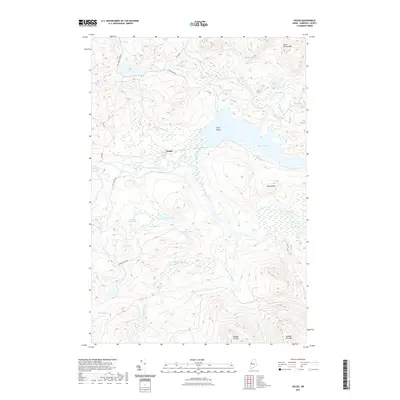
2021 Map of Holeb
USGS Topo · Published 2021About this map
Holeb serves as the central focal point of this Somerset County landscape, situated at a bend in the Moose River. The area is defined by a dense network of interconnected waterways and wetlands, including the expansive Holeb Pond and the unique geography of Birch Island. The drainage patterns are intricate, with Holeb Stream, McKenney Brook, and Turner Brook feeding into the larger river system. To the south, the topography rises sharply toward the summits of Number Six Mtn and Number Five Mtn, while Attean Mtn dominates the eastern view. This 2021 survey illustrates a region shaped by its glacial legacy, evident in the numerous small kettle ponds like Little Fish Pond and Grassy Pond. Local access is maintained through a system of forestry and access roads, including Holeb Rd and Big Turner Pond Rd, which weave through the timberland between the water bodies.
Find a feature on this map
32 named features on this map. Tap any name to fly to it.
Don’t see what you’re looking for? This feature index may not catch every label — zoom into the map to look around manually.
Map Details
Editions of this 2021 Holeb Map
This is the sole edition of this map. No revisions or reprints were ever made.
Other maps of this area

1923 · Attean
USGS Topo · 1:62,500

1925 · Attean
USGS Topo · 1:62,500

1928 · Chain Lakes
USGS Topo · 1:48,000

1928 · Skinner
USGS Topo · 1:48,000

1928 · Spencer
USGS Topo · 1:48,000

1931 · Skinner
USGS Topo · 1:62,500

1932 · Spencer
USGS Topo · 1:62,500

1932 · Chain Lakes
USGS Topo · 1:62,500

1935 · Chain Lakes
USGS Topo · 1:62,500

1949 · Jackman
USGS Topo · 1:250,000
Featured Places
- Dennistown Plantation, ME
- Rayton Township, ME
- Holeb Township, ME
- Attean Township, ME
- Forsyth Township, ME