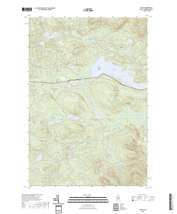
2024 Map of Holeb
USGS Topo · Published 2024About this map
Holeb serves as a central point in this northern forest landscape, situated near the winding course of the Moose River. The terrain is defined by a dense network of water bodies and prominent peaks, including Attean Mtn and Burnt Jacket Mtn. Navigating the interior is facilitated by historic routes such as Old Skinner Rd and Holeb Pond Rd, which connect various remote ponds and bog lands. Notable aquatic features like Holeb Pond, featuring Birch Island, and the larger Big Fish Pond indicate a region shaped by glacial geography and a legacy of timber and recreation. The presence of Camel Rips along the river highlights the natural river features that have long influenced travel through this part of Somerset County. Local nomenclature, such as Number Five Mtn and Number Six Mtn, reflects the systematic township surveying characteristic of the Maine North Woods.
Find a feature on this map
32 named features on this map. Tap any name to fly to it.
Don’t see what you’re looking for? This feature index may not catch every label — zoom into the map to look around manually.
Map Details
Editions of this 2024 Holeb Map
This is the sole edition of this map. No revisions or reprints were ever made.
Other maps of this area

1923 · Attean
USGS Topo · 1:62,500

1925 · Attean
USGS Topo · 1:62,500

1928 · Chain Lakes
USGS Topo · 1:48,000

1928 · Skinner
USGS Topo · 1:48,000

1928 · Spencer
USGS Topo · 1:48,000

1931 · Skinner
USGS Topo · 1:62,500

1932 · Spencer
USGS Topo · 1:62,500

1932 · Chain Lakes
USGS Topo · 1:62,500

1935 · Chain Lakes
USGS Topo · 1:62,500

1949 · Jackman
USGS Topo · 1:250,000
Featured Places
- Dennistown Plantation, ME
- Attean Township, ME
- Rayton Township, ME
- Forsyth Township, ME
- Appleton Township, ME