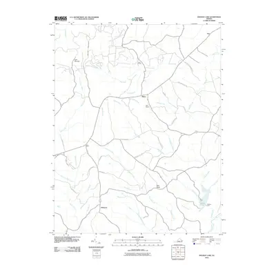
2010 Map of Holiday Lake
USGS Topo · Published 2010About this map
Appomattox Buckingham SF dominates the southwestern portion of this Central Virginia landscape, where managed woodlands meet the upper drainage basins of the Slate River and the Appomattox River. The terrain is defined by low ridges like Gunner Mountain and Kyles Mountain, with human activity concentrated around crossroads settlements and rural hubs such as Hollywood, Toga, and Fore Store. The creation of Holiday Lake and its associated Holiday Dam at the confluence of several creeks provides a major water feature in an otherwise heavily forested area. This 2010 topographic record captures the rural character of the region, including small local infrastructure such as the Toga Airport and Mann Cemetery, alongside a network of timber and access roads like Slate River Forest Rd and Rinehart Forest Rd that weave through the state forest lands.
Find a feature on this map
46 named features on this map. Tap any name to fly to it.
Don’t see what you’re looking for? This feature index may not catch every label — zoom into the map to look around manually.
Map Details
Editions of this 2010 Holiday Lake Map
This is the sole edition of this map. No revisions or reprints were ever made.
Other maps of this area

1892 · Buckingham
USGS Topo · 1:125,000

1892 · Appomattox
USGS Topo · 1:125,000

1947 · Roanoke
USGS Topo · 1:250,000

1958 · Appomattox
USGS Topo · 1:62,500

1958 · Pamplin City
USGS Topo · 1:62,500

1959 · Roanoke
USGS Topo · 1:250,000

1961 · Shipman
USGS Topo · 1:62,500

1961 · Buckingham
USGS Topo · 1:62,500

1963 · Roanoke
USGS Topo · 1:250,000

1967 · Andersonville
USGS Topo · 1:24,000