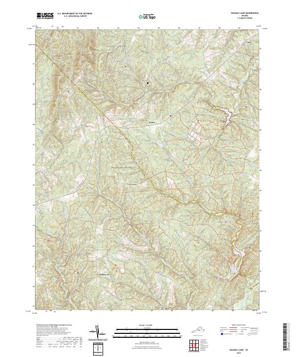
2022 Map of Holiday Lake
USGS Topo · Published 2022About this map
Holiday Lake sits at the heart of this central Virginia landscape, where the border between Buckingham and Appomattox Counties winds through a dense network of creek valleys and ridges. Small settlements like Sliders and Hollywood serve as focal points for a rural area defined by its drainages, including Fishpond Cr, Stillhouse Cr, and Webb Mill Cr. The map shows a transition from the upland elevations of Kyles Mtn and Gunner Mtn in the northwest toward the headwaters of major Virginia waterways, including the Appomattox River, Slate River, and Willis River.
Find a feature on this map
56 named features on this map. Tap any name to fly to it.
Don’t see what you’re looking for? This feature index may not catch every label — zoom into the map to look around manually.
Map Details
Editions of this 2022 Holiday Lake Map
This is the sole edition of this map. No revisions or reprints were ever made.
Other maps of this area

1892 · Buckingham
USGS Topo · 1:125,000

1892 · Appomattox
USGS Topo · 1:125,000

1947 · Roanoke
USGS Topo · 1:250,000

1958 · Appomattox
USGS Topo · 1:62,500

1958 · Pamplin City
USGS Topo · 1:62,500

1959 · Roanoke
USGS Topo · 1:250,000

1961 · Shipman
USGS Topo · 1:62,500

1961 · Buckingham
USGS Topo · 1:62,500

1963 · Roanoke
USGS Topo · 1:250,000

1967 · Andersonville
USGS Topo · 1:24,000