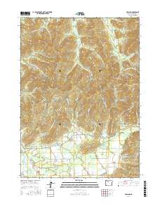
2017 Map of Holland
USGS Topo · Published 2017About this map
Bridgeview and Holland anchor this 2017 survey of Josephine County, Oregon, where the southern Illinois Valley transitions into steep mountain drainages. The East Fork Illinois River and its major tributaries, including Sucker Creek and McMullen Creek, define the local topography, carving deep gulches such as Peterson Gulch and Green Gulch. A network of rural routes and Bureau of Land Management (BLM) roads provides access to the surrounding hills, which rise toward landmarks like Lime Rock.
Find a feature on this map
113 named features on this map. Tap any name to fly to it.
Don’t see what you’re looking for? This feature index may not catch every label — zoom into the map to look around manually.
Map Details
Editions of this 2017 Holland Map
This is the sole edition of this map. No revisions or reprints were ever made.
Other maps of this area

1908 · Grants Pass
USGS Topo · 1:125,000

1917 · Kerby
USGS Topo · 1:125,000

1918 · Kerby
USGS Topo · 1:125,000

1945 · Kerby
USGS Topo · 1:125,000

1954 · Cave Junction
USGS Topo · 1:62,500

1954 · Oregon Caves
USGS Topo · 1:62,500

1954 · Selma
USGS Topo · 1:62,500

1954 · Grants Pass
USGS Topo · 1:62,500

1955 · Medford
USGS Topo · 1:250,000

1957 · Medford
USGS Topo · 1:250,000