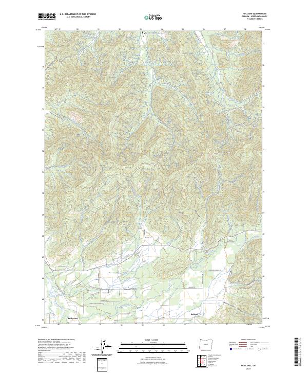
2023 Map of Holland
USGS Topo · Published 2023About this map
The Illinois Valley landscape dominates this modern survey, where the East Fork Illinois River meanders through a network of small drainages and agricultural land. The small community of Holland serves as a focal point near Mulvaney Gulch, while Bridgeview sits further west near the riverbanks. The terrain is marked by numerous seasonal and perennial watercourses, including Sucker Creek, Kelly Creek, and Bear Creek, which flow from the higher elevations of the surrounding mountains toward the valley floor.
Find a feature on this map
74 named features on this map. Tap any name to fly to it.
Don’t see what you’re looking for? This feature index may not catch every label — zoom into the map to look around manually.
Map Details
Editions of this 2023 Holland Map
This is the sole edition of this map. No revisions or reprints were ever made.
Other maps of this area

1908 · Grants Pass
USGS Topo · 1:125,000

1917 · Kerby
USGS Topo · 1:125,000

1918 · Kerby
USGS Topo · 1:125,000

1945 · Kerby
USGS Topo · 1:125,000

1954 · Cave Junction
USGS Topo · 1:62,500

1954 · Oregon Caves
USGS Topo · 1:62,500

1954 · Selma
USGS Topo · 1:62,500

1954 · Grants Pass
USGS Topo · 1:62,500

1955 · Medford
USGS Topo · 1:250,000

1957 · Medford
USGS Topo · 1:250,000