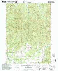
1996 Map of Holland
USGS Topo · Published 1999About this map
Fort Briggs (Historical Site) sits near the southern edge of this landscape, marking a point of pioneer significance in the Illinois Valley during the mid-1990s. The terrain is defined by a dense network of drainages including McMullin Creek, Thompson Creek, and Sucker Creek, which flow through the steep elevations surrounding Lime Rock. Small settlements like Holland and Bridgeview are positioned along the lower valley floors, connected by a series of primitive roads and 4wd tracks that reach into the high timber. The presence of several Quarry sites and a Gravel Pit suggests localized resource extraction was an active part of the rural economy. This revision by the USDA Forest Service highlights the complex topography where the Illinois River and Althouse Cr meet, providing a detailed record of the land use and hydrology before the turn of the millennium.
Find a feature on this map
27 named features on this map. Tap any name to fly to it.
Don’t see what you’re looking for? This feature index may not catch every label — zoom into the map to look around manually.
Map Details
Editions of this 1996 Holland Map
This is the sole edition of this map. No revisions or reprints were ever made.
Other maps of this area

1908 · Grants Pass
USGS Topo · 1:125,000

1917 · Kerby
USGS Topo · 1:125,000

1918 · Kerby
USGS Topo · 1:125,000

1945 · Kerby
USGS Topo · 1:125,000

1954 · Cave Junction
USGS Topo · 1:62,500

1954 · Oregon Caves
USGS Topo · 1:62,500

1954 · Selma
USGS Topo · 1:62,500

1954 · Grants Pass
USGS Topo · 1:62,500

1955 · Medford
USGS Topo · 1:250,000

1957 · Medford
USGS Topo · 1:250,000