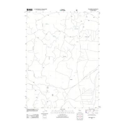
2012 Map of Hollenbeck
USGS Topo · Published 2012About this map
Hollenbeck and Scarface are the primary focal points of this Modoc County survey, which reveals a remote landscape defined by volcanic geology and timber industry access. The area's water sources reflect its working history, with names like Crystal Waterhole, Dustys Waterhole, and Chuckwagon Spring indicating the importance of these isolated points for livestock and travelers. The terrain is marked by the High Reefs and Hollenbeck Butte, while Sugar Pine Ridge suggests the local flora that once dominated the high-altitude environment.
Find a feature on this map
28 named features on this map. Tap any name to fly to it.
Don’t see what you’re looking for? This feature index may not catch every label — zoom into the map to look around manually.
Map Details
Editions of this 2012 Hollenbeck Map
This is the sole edition of this map. No revisions or reprints were ever made.
Other maps of this area

1886 · Modoc Lava Bed
USGS Topo · 1:250,000

1892 · Modoc Lava-Bed
USGS Topo · 1:250,000

1952 · Timber Mountain
USGS Topo · 1:62,500

1952 · Hackamore
USGS Topo · 1:62,500

1954 · Alturas
USGS Topo · 1:250,000

1958 · Alturas
USGS Topo · 1:250,000

1962 · Alturas
USGS Topo · 1:250,000

1962 · Crank Mountain
USGS Topo · 1:62,500

1962 · White Horse
USGS Topo · 1:62,500

1965 · Alturas
USGS Topo · 1:250,000