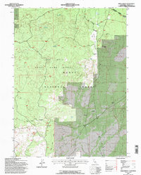
1993 Map of Hollenbeck
USGS Topo · Published 1996About this map
Modoc National Forest encompasses this high desert and volcanic landscape, where the Long Bell State Game Refuge and the Doublehead Ranger District intersect. The terrain is defined by volcanic features like Hollenbeck Butte and the High Reefs, which contrast with the level expanse of Hollenbeck Flat. Managed for wildlife and timber, the area is dotted with remote water sources such as Big Waterhole, Crystal Waterholes, and Dustys Waterhole, essential for the region's cattle and game.
Find a feature on this map
20 named features on this map. Tap any name to fly to it.
Don’t see what you’re looking for? This feature index may not catch every label — zoom into the map to look around manually.
Map Details
Editions of this 1993 Hollenbeck Map
This is the sole edition of this map. No revisions or reprints were ever made.
Other maps of this area

1886 · Modoc Lava Bed
USGS Topo · 1:250,000

1892 · Modoc Lava-Bed
USGS Topo · 1:250,000

1952 · Timber Mountain
USGS Topo · 1:62,500

1952 · Hackamore
USGS Topo · 1:62,500

1954 · Alturas
USGS Topo · 1:250,000

1958 · Alturas
USGS Topo · 1:250,000

1962 · Alturas
USGS Topo · 1:250,000

1962 · Crank Mountain
USGS Topo · 1:62,500

1962 · White Horse
USGS Topo · 1:62,500

1965 · Alturas
USGS Topo · 1:250,000