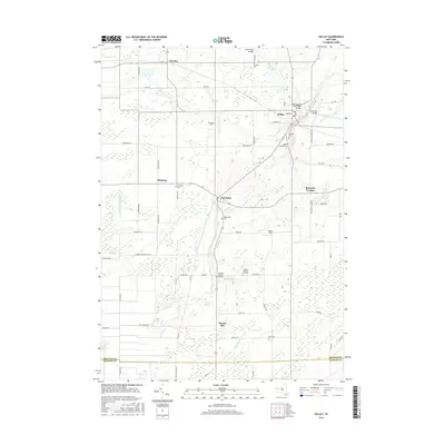
2016 Map of Holley
USGS Topo · Published 2016About this map
The Erie Canal cuts through the northeastern corner of this landscape, a defining feature for the village of Holley. This 2016 survey illustrates the persistent agricultural and small-town character of Orleans County, where the terrain transitions from the canal corridor toward the rise of Honest Hill. The map is particularly dense with small, family-named burial sites and historic cemeteries, including the Robinson Burying Ground, Glidden Burying Ground, and Pioneer Cem. These sites, alongside the namesake village of Clarendon, reflect a deeply rooted settlement pattern established well before the modern era. Waterways like E Br Sandy Cr and the drainage of Manning Muckland Cr define the rural stretches between local hubs such as Fancher and Manning. For those tracking local history, the placement of Hillside Cem and Holy Cross Cem near the canal suggests the long-term community growth centered around the historic waterway.
Find a feature on this map
61 named features on this map. Tap any name to fly to it.
Don’t see what you’re looking for? This feature index may not catch every label — zoom into the map to look around manually.
Map Details
Editions of this 2016 Holley Map
This is the sole edition of this map. No revisions or reprints were ever made.
Other maps of this area

1897 · Albion
USGS Topo · 1:62,500

1897 · Oak Orchard
USGS Topo · 1:62,500

1899 · Hamlin
USGS Topo · 1:62,500

1899 · Brockport
USGS Topo · 1:62,500

1932 · Hamlin
USGS Topo · 1:24,000

1934 · Brockport
USGS Topo · 1:24,000

1935 · Churchville
USGS Topo · 1:24,000

1935 · Hamlin
USGS Topo · 1:24,000

1944 · Churchville
USGS Topo · 1:31,680

1944 · Holley
USGS Topo · 1:31,680