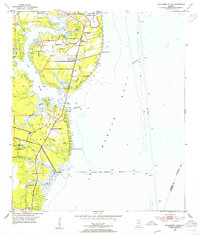
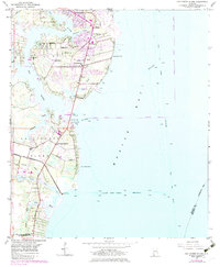
1953 Map of Hollingers Island
USGS Topo · Published 1955About this map
Mobile Bay defines the eastern shoreline of this 1953 revision, where the infrastructure of the Brookley Air Force Base transitions into the residential and recreational landscapes of South Brookley. The map details a complex coastal geography where Dog River and its many tributaries, such as Halls Mill Creek and Robinson Bayou, create a network of marshes and inlets. Social hubs like the Alba Club, Mobile Yacht Club, and the Gulf Fishing and Hunting Club underscore the area's mid-century identity as a waterfront retreat.
Find a feature on this map
34 named features on this map. Tap any name to fly to it.
Don’t see what you’re looking for? This feature index may not catch every label — zoom into the map to look around manually.
Map Details
Editions of this 1953 Hollingers Island Map
5 editions found
Other maps of this area

1921 · Point Clear
USGS Topo · 1:62,500

1921 · Fairhope
USGS Topo · 1:62,500

1921 · Delchamps
USGS Topo · 1:62,500

1922 · Mobile
USGS Topo · 1:62,500

1939 · Daphne
USGS Topo · 1:31,680

1940 · Hollingers Island
USGS Topo · 1:31,680

1940 · Mobile
USGS Topo · 1:31,680

1940 · Mobile
USGS Topo · 1:62,500

1941 · Daphne
USGS Topo · 1:31,680

1941 · Cedar Point
USGS Topo · 1:62,500