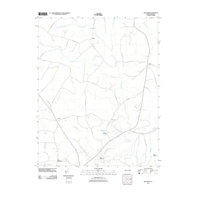
2010 Map of Hollister
USGS Topo · Published 2010About this map
Old Bethlehem and Hollister anchor this rural landscape in the northeastern corner of North Carolina. The area is defined by a dendritic network of waterways, with Little Fishing Creek and its many tributaries, including Bens Creek, Reedy Creek, and Porter Creek, carving through the countryside. Near the southern edge, the elevation rises toward Medoc Mountain, a prominent landmark that overlooks the beginning of Bear Swamp.
Find a feature on this map
50 named features on this map. Tap any name to fly to it.
Don’t see what you’re looking for? This feature index may not catch every label — zoom into the map to look around manually.
Map Details
Editions of this 2010 Hollister Map
This is the sole edition of this map. No revisions or reprints were ever made.
Other maps of this area

1953 · Norfolk
USGS Topo · 1:250,000

1953 · Greensboro
USGS Topo · 1:250,000

1954 · Greensboro
USGS Topo · 1:250,000

1962 · Greensboro
USGS Topo · 1:250,000

1963 · Ringwood
USGS Topo · 1:24,000

1963 · Essex
USGS Topo · 1:24,000

1966 · Greensboro
USGS Topo · 1:250,000
1970 · Macon
USGS Topo · 1:24,000

1971 · Inez
USGS Topo · 1:24,000

1973 · Aurelian Springs
USGS Topo · 1:24,000