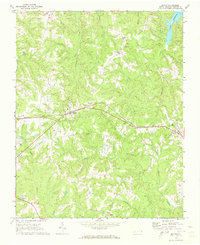
1970 Map of Macon
USGS Topo · Published 1973About this map
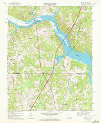
Macon serves as a central hub in Warren County, defined by the corridor of the Seaboard Coast Line railroad as it stretches toward Vaughan. The landscape is a network of small agricultural settlements and rural congregations, including Oakville, Church Hill, and Embro. Deeply dissected by numerous watercourses, the area features the headwaters of Little Fishing Creek and the southern reach of Lake Gaston. Genealogists and local historians will find several well-established rural churches, such as Greenwood Ch, New Bethel Ch, and Mt Zion Ch, often paired with local burial grounds like Greenwood Cem. The presence of the Warrenton Country Club in the southwest and named thoroughfares like Walkers road further illustrates the community layout during the early 1970s.
Find a feature on this map
28 named features on this map. Tap any name to fly to it.
Don’t see what you’re looking for? This feature index may not catch every label — zoom into the map to look around manually.
Map Details
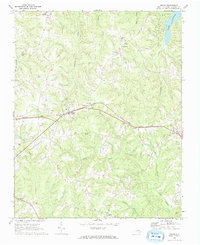
Editions of this 1970 Macon Map
2 editions found
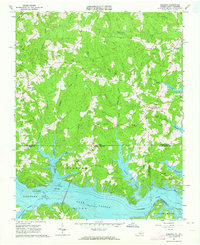
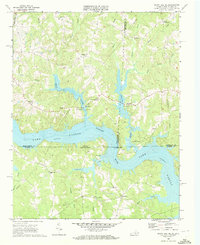
Other maps of this area

1919 · White Plains
USGS Topo · 1:48,000

1920 · White Plains
USGS Topo · 1:62,500

1953 · Norfolk
USGS Topo · 1:250,000

1953 · Greensboro
USGS Topo · 1:250,000

1954 · Greensboro
USGS Topo · 1:250,000

1962 · Greensboro
USGS Topo · 1:250,000
1963 · Gasburg
USGS Topo · 1:24,000

1966 · Greensboro
USGS Topo · 1:250,000
1968 · South Hill SE
USGS Topo · 1:24,000
1968 · Bracey
USGS Topo · 1:24,000