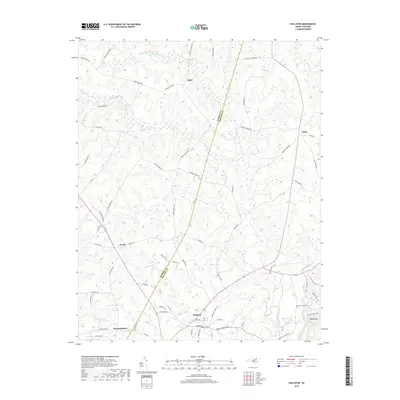
2019 Map of Hollister
USGS Topo · Published 2019About this map
Hollister and Arcola center this 2019 survey of the rural borderland between Warren and Halifax counties. The landscape is defined by the winding course of Little Fishing Cr and its many tributaries, including Porter Cr and Reedy Cr. This area maintains a dispersed residential character, with small settlements like Odell and Airlie connected by a network of named country roads that often follow the ridgelines.
Find a feature on this map
70 named features on this map. Tap any name to fly to it.
Don’t see what you’re looking for? This feature index may not catch every label — zoom into the map to look around manually.
Map Details
Editions of this 2019 Hollister Map
This is the sole edition of this map. No revisions or reprints were ever made.
Other maps of this area

1953 · Norfolk
USGS Topo · 1:250,000

1953 · Greensboro
USGS Topo · 1:250,000

1954 · Greensboro
USGS Topo · 1:250,000

1962 · Greensboro
USGS Topo · 1:250,000

1963 · Ringwood
USGS Topo · 1:24,000

1963 · Essex
USGS Topo · 1:24,000

1966 · Greensboro
USGS Topo · 1:250,000
1970 · Macon
USGS Topo · 1:24,000

1971 · Inez
USGS Topo · 1:24,000

1973 · Aurelian Springs
USGS Topo · 1:24,000