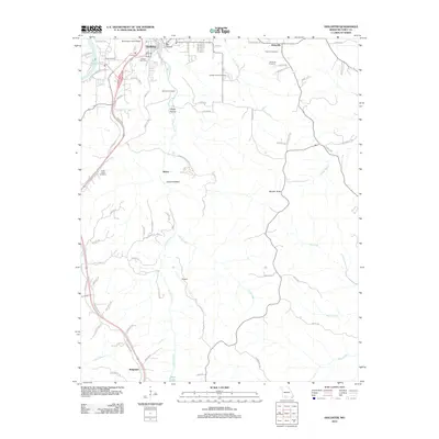
2012 Map of Hollister
USGS Topo · Published 2012About this map
Lake Taneycomo defines the northwestern corner of this Taney County landscape, where the town of Hollister sits across from the regional hub of Branson. This 2012 survey documents the modern layout of the M Graham Clark Airport and the complex road network branching from US Highway 65. The area is characterized by deep ravines and distinct topographical features such as Big Hollow, Happy Hollow, and Coalpit Hollow, which drain into the prominent Turkey Creek corridor. Genealogists will find several burial sites preserved among the modern developments, including Ellison Cemetery, Whorton Cemetery, and Gobbler Knob Cemetery. Farther south toward the Arkansas border, the community of Ridgedale appears near the shores of Shaw Lake. This map captures a moment of transition between established Ozark settlements like Melva and the expanding residential and commercial infrastructure of the early 21st century.
Find a feature on this map
81 named features on this map. Tap any name to fly to it.
Don’t see what you’re looking for? This feature index may not catch every label — zoom into the map to look around manually.
Map Details
Editions of this 2012 Hollister Map
This is the sole edition of this map. No revisions or reprints were ever made.
Other maps of this area

1904 · Harrison
USGS Topo · 1:125,000

1905 · Harrison
USGS Topo · 1:125,000

1907 · Forsyth
USGS Topo · 1:125,000

1945 · Harrison
USGS Topo · 1:250,000

1949 · Harrison
USGS Topo · 1:250,000

1950 · Garber
USGS Topo · 1:24,000

1954 · Harrison
USGS Topo · 1:250,000

1956 · Table Rock Dam
USGS Topo · 1:24,000

1956 · Garber
USGS Topo · 1:24,000
1956 · Mincy
USGS Topo · 1:24,000