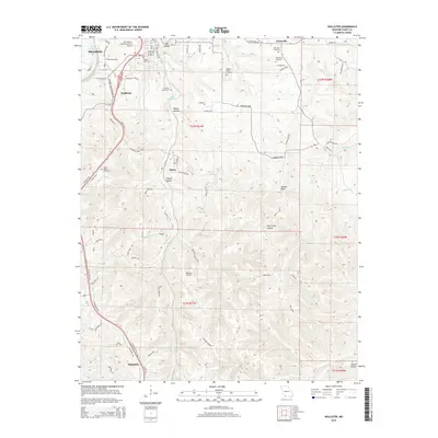
2015 Map of Hollister
USGS Topo · Published 2015About this map
Lake Taneycomo snakes through the northern portion of this map, serving as a focal point for the communities of Branson and Hollister. The landscape is defined by the Ozark Plateau's characteristic dissected topography, featuring numerous hollows such as Big Hollow, Happy Hollow, and Coalpit Hollow. This 2015 survey reveals a blend of aviation history and local genealogy, anchored by the M. Graham Clark Downtown Airport in the north and the larger Branson Airport to the south.
Find a feature on this map
90 named features on this map. Tap any name to fly to it.
Don’t see what you’re looking for? This feature index may not catch every label — zoom into the map to look around manually.
Map Details
Editions of this 2015 Hollister Map
This is the sole edition of this map. No revisions or reprints were ever made.
Other maps of this area

1904 · Harrison
USGS Topo · 1:125,000

1905 · Harrison
USGS Topo · 1:125,000

1907 · Forsyth
USGS Topo · 1:125,000

1945 · Harrison
USGS Topo · 1:250,000

1949 · Harrison
USGS Topo · 1:250,000

1950 · Garber
USGS Topo · 1:24,000

1954 · Harrison
USGS Topo · 1:250,000

1956 · Table Rock Dam
USGS Topo · 1:24,000

1956 · Garber
USGS Topo · 1:24,000
1956 · Mincy
USGS Topo · 1:24,000