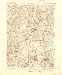
1942 Map of Holliston
USGS Topo · Published 1942About this map
The town of Holliston serves as a central hub on this 1942 preliminary edition, situated amidst a landscape of prominent drumlins and wetlands. This survey, conducted just before the United States entered World War II, illustrates the intricate boundary lines where Middlesex, Worcester, and Norfolk counties converge. Significant infrastructure including the Boston and Albany RR and the New York New Haven and Hartford RR crisscross the region, connecting smaller industrial and residential hamlets like West Medway and Braggville.
Find a feature on this map
99 named features on this map. Tap any name to fly to it.
Don’t see what you’re looking for? This feature index may not catch every label — zoom into the map to look around manually.
Map Details
Editions of this 1942 Holliston Map
2 editions found
Other maps of this area

1886 · Blackstone
USGS Topo · 1:62,500

1886 · Framingham
USGS Topo · 1:62,500

1887 · Franklin
USGS Topo · 1:62,500

1887 · Marlboro
USGS Topo · 1:62,500

1889 · Marlboro
USGS Topo · 1:62,500

1889 · Blackstone
USGS Topo · 1:62,500

1889 · Franklin
USGS Topo · 1:62,500

1889 · Framingham
USGS Topo · 1:62,500

1893 · Franklin
USGS Topo · 1:62,500

1893 · Blackstone
USGS Topo · 1:62,500