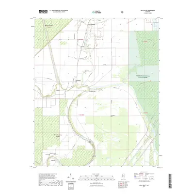
2021 Map of Holly Bluff
USGS Topo · Published 2021About this map
Holly Bluff and the surrounding alluvial lowlands of Yazoo and Sharkey Counties dominate this 2021 landscape, where the Big Sunflower River winds through a complex system of levees and bayous. The map captures a high degree of genealogical detail with several family-named burial sites including Shannon Cem, Jeffery Cem, and Kettleman Cem near the site of Spanish Fort. This area's transition from agricultural production to conservation is evident in the presence of the Delta National Forest and Panther Swamp National Wildlife Refuge.
Find a feature on this map
55 named features on this map. Tap any name to fly to it.
Don’t see what you’re looking for? This feature index may not catch every label — zoom into the map to look around manually.
Map Details
Editions of this 2021 Holly Bluff Map
This is the sole edition of this map. No revisions or reprints were ever made.
Other maps of this area

1939 · Onward
USGS Topo · 1:62,500

1939 · Lorenzen
USGS Topo · 1:62,500

1940 · Mechanicsburg
USGS Topo · 1:62,500

1955 · Jackson
USGS Topo · 1:250,000

1961 · Jackson
USGS Topo · 1:250,000

1961 · Bayland
USGS Topo · 1:62,500

1962 · Jackson
USGS Topo · 1:250,000

1963 · Mechanicsburg
USGS Topo · 1:62,500

1963 · Onward
USGS Topo · 1:62,500

1964 · Lorenzen
USGS Topo · 1:62,500