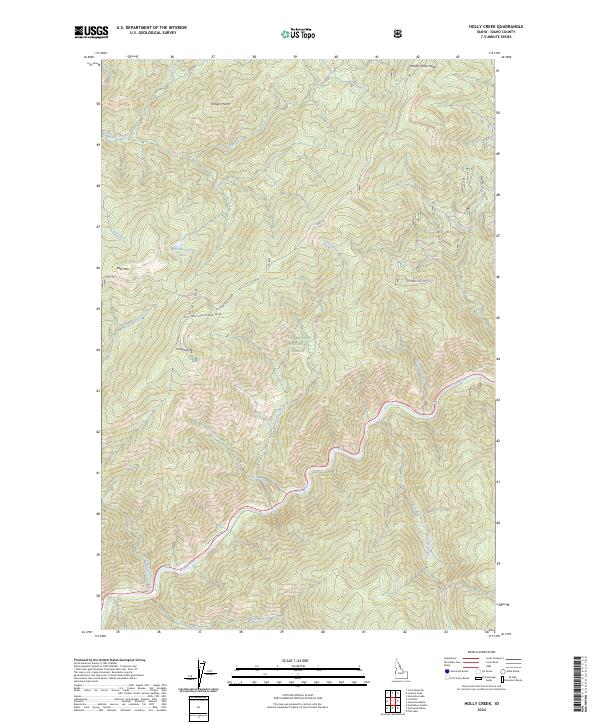
2024 Map of Holly Creek
USGS Topo · Published 2024About this map
Clearwater National Forest dominates this Idaho landscape, characterized by steep drainage basins and high ridgelines. The Middle Fork Clearwater Wild and Scenic River and the Lochsa River converge in the southern reaches, highlighting the region's importance to the interior river system. This area is historically significant for its transit routes, most notably the Lolo Trl, which winds across the high ground between peaks like Indian Grave Peak and Bald Mtn. Local topography is marked by named summits including Castle Butte and Hungry Point, which provide vantage points over the complex network of creeks such as Weitas Creek and Holly Creek. The map shows contemporary forest management through features like the Natl Forest Develop Road 561 Rd, which provides access to the interior wilderness near Bald Mountain Lake.
Find a feature on this map
38 named features on this map. Tap any name to fly to it.
Don’t see what you’re looking for? This feature index may not catch every label — zoom into the map to look around manually.
Map Details
Editions of this 2024 Holly Creek Map
This is the sole edition of this map. No revisions or reprints were ever made.
Other maps of this area

1911 · Lolo
USGS Topo · 1:250,000

1913 · Lolo
USGS Topo · 1:250,000

1956 · Hamilton
USGS Topo · 1:250,000

1959 · Hamilton
USGS Topo · 1:250,000

1960 · Hamilton
USGS Topo · 1:250,000

1964 · Hamilton
USGS Topo · 1:250,000

1965 · Lookout Peak
USGS Topo · 1:24,000
1965 · Cook Mountain
USGS Topo · 1:24,000

1965 · Horseshoe Lake
USGS Topo · 1:24,000
1966 · Greenside Butte
USGS Topo · 1:24,000