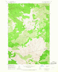
1965 Map of Cook Mountain
USGS Topo · Published 1967About this map
Magary Camp sits along the western edge of this 1965 survey, marking a human presence in the dense timberlands of the Clearwater National Forest. The landscape is dominated by high ridgelines and isolated summits, including Cook Mountain and the prominent Buck Ridge. This mid-century study captures the drainage patterns of the Weitas Creek watershed, where numerous smaller streams like Johnny Creek and Doris Creek carve through the steep terrain. The lack of improved roads highlights the reliance on the Pack Trail network for traversing these high-altitude environments. Near the southern border, the map identifies the boundary between Clearwater and Idaho Counties, crossing through the vicinity of Smith Butte. This document provides a look at the backcountry infrastructure used for forest management and fire observation before modern development altered the region's accessibility.
Find a feature on this map
24 named features on this map. Tap any name to fly to it.
Don’t see what you’re looking for? This feature index may not catch every label — zoom into the map to look around manually.
Map Details
Editions of this 1965 Cook Mountain Map
2 editions found
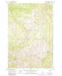
Other maps of this area

1911 · Lolo
USGS Topo · 1:250,000

1913 · Lolo
USGS Topo · 1:250,000

1956 · Hamilton
USGS Topo · 1:250,000

1959 · Hamilton
USGS Topo · 1:250,000

1960 · Hamilton
USGS Topo · 1:250,000

1964 · Hamilton
USGS Topo · 1:250,000

1965 · Junction Mtn
USGS Topo · 1:24,000

1965 · Lean-to Point
USGS Topo · 1:24,000

1965 · Scurvy Mtn.
USGS Topo · 1:24,000

1965 · Lookout Peak
USGS Topo · 1:24,000