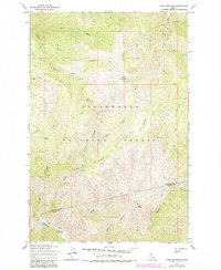
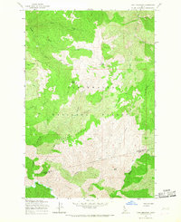
1965 Map of Cook Mountain
USGS Topo · Published 1984About this map
Cook Mountain stands as a central peak in this high-elevation stretch of the Clearwater National Forest, where the landscape is defined by an intricate network of drainages and prominent divides. Significant ridges such as Buck Ridge and Johnagan Ridge separate various watercourses, including Johnny Creek and Weitas Creek, illustrating the complex drainage patterns of the Clearwater and Idaho county border region. This survey, updated with 1980s forest data, shows a wilderness primarily accessible by a historic system of paths like the Pack Trail and Windy Trail. High-country landmarks such as Fox Butte, Smith Butte, and the open expanses of Crater Meadows provide critical navigation points for those studying the backcountry topography of the mid-20th century. The absence of paved roads emphasizes the remote character of these woods during the period when the U.S. Forest Service actively monitored these slopes.
Find a feature on this map
24 named features on this map. Tap any name to fly to it.
Don’t see what you’re looking for? This feature index may not catch every label — zoom into the map to look around manually.
Map Details
Editions of this 1965 Cook Mountain Map
2 editions found
Other maps of this area

1911 · Lolo
USGS Topo · 1:250,000

1913 · Lolo
USGS Topo · 1:250,000

1956 · Hamilton
USGS Topo · 1:250,000

1959 · Hamilton
USGS Topo · 1:250,000

1960 · Hamilton
USGS Topo · 1:250,000

1964 · Hamilton
USGS Topo · 1:250,000

1965 · Junction Mtn
USGS Topo · 1:24,000

1965 · Lean-to Point
USGS Topo · 1:24,000

1965 · Scurvy Mtn.
USGS Topo · 1:24,000

1965 · Lookout Peak
USGS Topo · 1:24,000