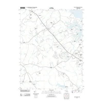
2011 Map of Hollywood
USGS Topo · Published 2011About this map
Hollywood stands at the center of this southern Maryland landscape, where established communities and newer residential subdivisions meet the tidal tributaries of the Patuxent River. The area is defined by its maritime and agricultural roots, evidenced by names like Clarks Landing and Saint Cuthbert Wharf along the Cuckold Creek and Mill Creek inlets. To the south, the Saint Marys River and its Western Branch carve through the terrain, supporting the Saint Marys River Watershed Number 1 Dam and Saint Marys Lake. Local history is anchored by spiritual and civic sites, including Joy Chapel, Saint Johns Church, and Our Ladys Chapel. The presence of the Saint Marys County Airport and the expanding development around California and Wildewood illustrates the 21st-century growth patterns of Saint Marys County, while small settlements like Laceys Venture and Winterseat preserve the character of the older coastal plain.
Find a feature on this map
171 named features on this map. Tap any name to fly to it.
Don’t see what you’re looking for? This feature index may not catch every label — zoom into the map to look around manually.
Map Details
Editions of this 2011 Hollywood Map
This is the sole edition of this map. No revisions or reprints were ever made.
Other maps of this area

1892 · Leonardtown
USGS Topo · 1:62,500

1892 · Drum Point
USGS Topo · 1:62,500

1892 · Piney Point
USGS Topo · 1:62,500

1894 · Piney Point
USGS Topo · 1:62,500

1894 · Point Lookout
USGS Topo · 1:62,500

1895 · Leonardtown
USGS Topo · 1:62,500

1895 · Nomini
USGS Topo · 1:125,000

1895 · Piney Point
USGS Topo · 1:62,500

1898 · Nomini
USGS Topo · 1:125,000

1898 · St. Marys
USGS Topo · 1:125,000
Featured Places
- Lexington Park, MD
- California, Lexington Park
- Wildewood, Lexington Park
- Leonardtown, MD
- Fenwick Manor, MD