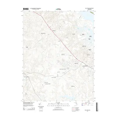
2014 Map of Hollywood
USGS Topo · Published 2014About this map
St Mary's County Regional Airport anchors the central landscape of Saint Mary's County, serving as a modern hub between the growing residential corridors of Hollywood and California. The map reveals a high density of named developments and subdivisions such as Holly Gaf Acres, Laceys Venture, and the uniquely named Middle Earth. These newer residential footprints contrast with the area's deeper heritage, marked by numerous religious and burial sites including Saint Johns Cem, Joy Chapel Cem, and Our Ladys Chapel Cem. Near the eastern shore, the topography transitions into the tidal inlets of the Patuxent River, where Clarks Landing and Scotch Point overlook Cuckold Creek and Nats Creek. The road network is dominated by the diagonal pulse of MD-235, which links these suburban clusters to the seat of Leonardtown in the southwest near Breton Bay.
Find a feature on this map
52 named features on this map. Tap any name to fly to it.
Don’t see what you’re looking for? This feature index may not catch every label — zoom into the map to look around manually.
Map Details
Editions of this 2014 Hollywood Map
This is the sole edition of this map. No revisions or reprints were ever made.
Other maps of this area

1892 · Leonardtown
USGS Topo · 1:62,500

1892 · Drum Point
USGS Topo · 1:62,500

1892 · Piney Point
USGS Topo · 1:62,500

1894 · Piney Point
USGS Topo · 1:62,500

1894 · Point Lookout
USGS Topo · 1:62,500

1895 · Leonardtown
USGS Topo · 1:62,500

1895 · Nomini
USGS Topo · 1:125,000

1895 · Piney Point
USGS Topo · 1:62,500

1898 · Nomini
USGS Topo · 1:125,000

1898 · St. Marys
USGS Topo · 1:125,000
Featured Places
- Lexington Park, MD
- California, Lexington Park
- Wildewood, Lexington Park
- Leonardtown, MD
- Fenwick Manor, MD