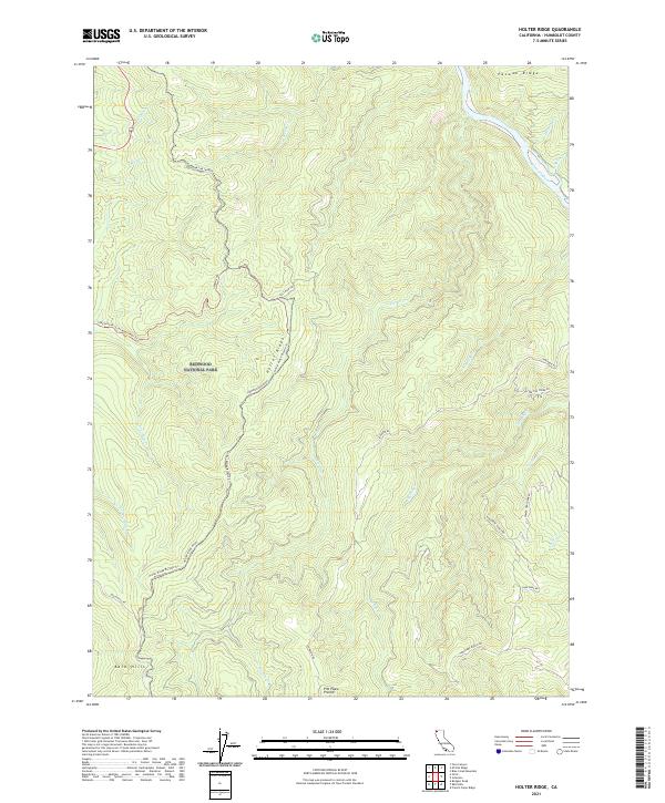
2021 Map of Holter Ridge
USGS Topo · Published 2021About this map
Redwood National Park preserves the complex terrain of the northern California coast on this sheet, where high ridges and deep drainages define the landscape. The Klamath Wild and Scenic River carves a path through the northeastern corner, bounded by the sharp rise of Pecwan Ridge. Further south, the map details a network of conservation and ranching history, from the wide opening of Pitt Place Prairie to the family-named landmarks such as Hancorne Ranch Rd. Transportation patterns reflect a shift from historic logging or ranch access to recreation, evidenced by the Holter Ridge Bicycle Trl and Lost Man Creek Trl winding through the timber. Numerous tributaries, including Little Lost Man Cr and Tectah Cr, feed the region's larger water systems, illustrating the dense hydrological network of Holter Ridge.
Find a feature on this map
36 named features on this map. Tap any name to fly to it.
Don’t see what you’re looking for? This feature index may not catch every label — zoom into the map to look around manually.
Map Details
Editions of this 2021 Holter Ridge Map
This is the sole edition of this map. No revisions or reprints were ever made.
Other maps of this area

1925 · Hoopa
USGS Topo · 1:125,000

1945 · Orick
USGS Topo · 1:62,500

1945 · Trinidad
USGS Topo · 1:62,500

1945 · Coyote Peak
USGS Topo · 1:62,500

1945 · Tectah Creek
USGS Topo · 1:62,500

1948 · Weed
USGS Topo · 1:250,000

1949 · Eureka
USGS Topo · 1:250,000

1950 · Weed
USGS Topo · 1:250,000
1952 · Orick
USGS Topo · 1:62,500

1952 · Coyote Peak
USGS Topo · 1:62,500