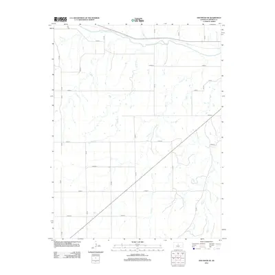
2012 Map of Holyrood NE
USGS Topo · Published 2012About this map
The Smoky Hill River meanders across the northern edge of this Ellsworth County landscape, defining the primary drainage for a network of prairie tributaries. This 2012 survey illustrates a highly structured agricultural grid, where section lines are demarcated by a systematic series of roads such as 7th Rd, 10th Rd, and Avenue N. The terrain is deeply etched by numerous waterways that cut through the plains, including Turkey Cr, Oxide Cr, and Little Wolf Cr. This hydrology dictates the local topography, with Buffalo Cr and Loss Cr flowing north toward the primary river valley. The map serves as a precise record of rural Kansas land division in the early 21st century, showing how the natural paths of Wolf Cr and other streams intersect with the rigid geometry of the public land survey system.
Find a feature on this map
23 named features on this map. Tap any name to fly to it.
Don’t see what you’re looking for? This feature index may not catch every label — zoom into the map to look around manually.
Map Details
Editions of this 2012 Holyrood NE Map
This is the sole edition of this map. No revisions or reprints were ever made.
Other maps of this area

1894 · Ellsworth
USGS Topo · 1:125,000

1955 · Great Bend
USGS Topo · 1:250,000

1956 · Wilson
USGS Topo · 1:24,000

1957 · Great Bend
USGS Topo · 1:250,000

1957 · Ellsworth
USGS Topo · 1:24,000

1957 · Westfall SW
USGS Topo · 1:24,000

1957 · Holyrood NE
USGS Topo · 1:24,000

1957 · Black Wolf
USGS Topo · 1:24,000

1958 · Great Bend
USGS Topo · 1:250,000
1964 · Holyrood NW
USGS Topo · 1:24,000